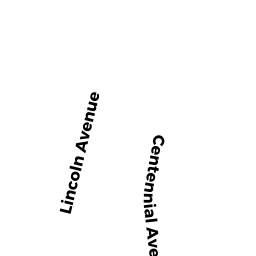
13 LINCOLN AV
Owner Information
HAINES CAROLINE E
13 LINCOLN AV
GLOUCESTER, MA 01930-2513


Property Details
13 LINCOLN AV is classified as a Single Family Residential (Bungalow).
The primary structure on this property was built in 1940. There are 2,282ft2 of built area within this property. There is 1,216ft2 of residential/living space within this property.
13 LINCOLN AV is valued at $336,700. The land is valued at $111,100 and the structures are valued at $214,500. There is an additional valuation of $11,100 on this property.
This property is in Zone R-5. Confirm with local Zoning Board authorities to ensure there are no overlays or other easements on this property.
The most recent deed for 13 LINCOLN AV is recorded at the local registrar in Book 30385, Page 191. 13 LINCOLN AV was last sold on Tuesday, May 3, 2011 for $280,000.
Assessment data from fiscal year 2022.
Flood Data
According to the FEMA National Flood Hazard Layer, this property does not appear to be in a flood zone. It may also be in an area not yet reviewed. Nonetheless, confirm this information prior to taking any action.
To view the flood hazards around this property, create a FEMA "Firmette" Map of the area around 13 LINCOLN AV.
Broadband Internet Providers
| Provider | Type | Bandwidth (mbps) | |
|---|---|---|---|
| Verizon New England Inc. | DSL | 15 | 1 |
| Viasat Inc | Satellite | 100 | 3 |
| VSAT Systems, LLC. | Satellite | 2 | 1 |
| HughesNet | Satellite | 25 | 3 |
| GCI Communication Corp. | Satellite | 0 | 0 |
| T-Mobile | Fixed Wireless | 25 | 3 |
| Comcast | Cable | 1000 | 35 |
Broadband service provider data from December 2020.
Adjacent Properties
- 15 LINCOLN AV
Single Family Residential owned by SIMOES CHRISTINE L & JOSEPH H - 64 CENTENNIAL AV
Two-Family Residential owned by LAFATA PETER M TR - 62B CENTENNIAL AV
Accessory Land with Improvement owned by LAFATA PETER P & ELIZABETH A - 11 LINCOLN AV
Two-Family Residential owned by WARREN DREW F & WAGNER RUTH P